Stay up-to-date with the latest content from SUPARCO as we explore and discover more about our home

Status of Glacial Lakes in Pakistan
Frozen / Unfrozen Lakes – May 2026 DistrictAstore Frozen / Cloudy ProvinceGilgit Baltistan Observation Date06-May-2026 Area 20260.08 sq. Km Max Area 20250.1 sq. Km DistrictDiamer Froze…
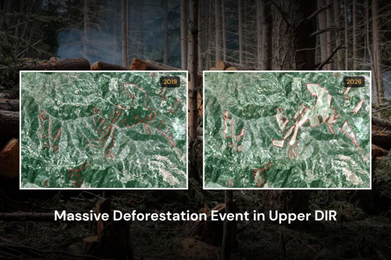
Massive Deforestation Event In Upper Dir
Massive deforestation event is observed from high resolution satellite data during period of 2019-2026. An estimated 66.58 ha natural forest tree cover has been ruthlessly cut down across 13…

Snow Cover Assessment
Satellite imagery analysis of 2023, 2024, 2025 and 2026 shows a notable variation in snow cover extent in the Upper Indus Basin (UIB), the Gilgit-Baltistan province, and the Chitral area in …
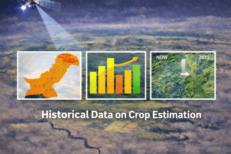
Historical Data on Crop Estimation
Satellite-based crop estimation in Pakistan provides comprehensive insights into the area, production, and yield of major crops including wheat, sugarcane, rice, and cotton. These estimates,…
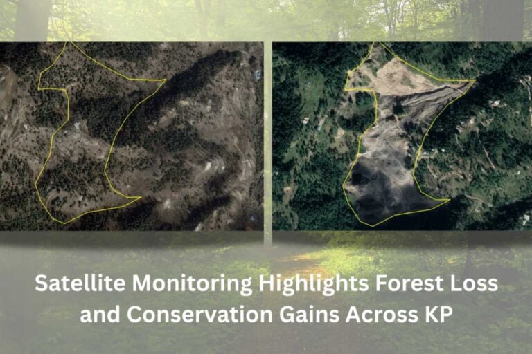
Satellite Monitoring Highlights Forest Loss and Conservation Gains Across KP
In Bisala Village, Mansehra district, mining activities within a forest ecosystem have caused drastic vegetation loss. Satellite analysis (2001 vs. 2025) reveals a reduction in forest tree c…
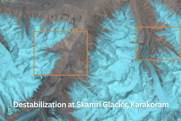
Destabilization at Skamri Glacier, Karakoram
New satellite data shows rapid destabilization at Skamri Glacier, Karakoram. Rising temperatures are accelerating glacier melt. Orange zones highlight expanding supraglacial lakes. Increased…
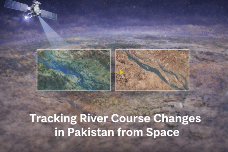
Tracking River Course Changes in Pakistan from Space
A river’s course, the path it follows from its source to its end, is not static. Rivers are dynamic systems that constantly adjust their shape, position, and-profile over time. These adjustm…
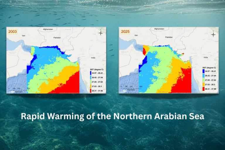
Rapid Warming of the Northern Arabian Sea
Satellite data from 2003 to 2025 shows rapid warming in the Northern Arabian Sea, with Pakistan’s coastal waters experiencing temperature increases between 0.7°C and over 3°C. Rising sea sur…
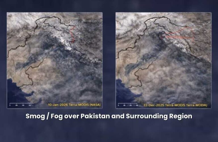
Smog / Fog over Pakistan and Surrounding Region
SUPARCO continuously monitors smog, fog, and aerosol loading over Pakistan using daily satellite observations, which play a critical role in understanding air quality patterns and their seas…